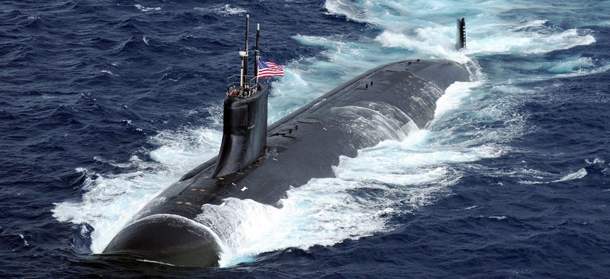
A Seawolf-class submarine, as above, carries an internal accelerometer so it can still benefit from GPS. Navy file photo
POSYDON Is Like GPS, But for Underwater Drones
The U.S. Navy is developing a new kind of system—built specifically for drone submarines.
To prepare for the possibility that it will one day deploy swarms of uncrewed drone submarines, the U.S. Navy is developing a system that will allow the global positioning system (GPS) to function deep below the ocean’s surface. If successful, the technology could start to appear as soon as the 2020s.
The global positioning system is a marvel of accurate clocks and simple physics. A GPS receiver, like the kind in smartphones or car navigation systems, is little more than a radio antenna tuned to satellites. It listens for signals from the three GPS satellites that happen to be closest (there are more than 50 satellites in total, all constantly broadcasting their time), then it triangulates its own location from where it knows those satellites to be. Though composed only of silent listeners and a constellation of passive beacons, GPS can tell someone where they are on or above the planet’s surface.
But take heed of the prepositions—on or above. Right now, GPS signals can barely go below.
“Radio signals do not propagate very far underwater,” says Joshua Niedzwiecki, the director of sensor processing at BAE Systems. BAE is researching and developing the new technology for the government. “If you put your cellphone in a waterproof case and went into the ocean, as you start getting deeper and deeper, you’d very soon lose connectivity.”
And since GPS radio signals don’t reach very far underwater, they’re basically useless for any submarine below the surface. The Navy solves this problem now by outfitting each sub with a “very large and very expensive inertial measurement unit,” says Niedzwiecki. (Imagine a tricked-out, military-grade version of the accelerometer in your phone.) By remembering the submarine’s last known surface position, as measured by GPS, then keeping close track of its forward movement and diving depth, these units can give a high-accuracy estimate of where the submarine is in space.
But they are still very expensive and very large. If the Navy wants to deploy dozens or even hundreds of them to drone submarines, then it will soon run out of both budget and available cargo space. It needs something closer to GPS, a set of lightweight passive beacons that can help something deduce location through triangulation alone. Hence the new BAE Systems project: the Positioning System for Deep Ocean Navigation, or POSYDON.
“We want to use signals that propagate very well underwater,” says Niedzwiecki. “And it turns out that acoustic signals propagate extremely well.”
POSYDON wants to install acoustic speakers in buoys throughout the ocean, where they will broadcast the time like GPS satellites. “They will be heard across very, very wide swaths of ocean,” he told me. “And now our underwater vehicles will be able to listen to those acoustic signals and measure the time difference of arrivals of each one of them.”
There’s one big problem. GPS radio signals are electromagnetic waves, so they move at the speed of light—always, through any atmospheric medium. This makes it extremely straightforward to back-compute the location of a beacon from its signal.
“Underwater acoustic signals, it’s a much more challenging problem,” says Niedzwiecki. “How fast they travel is a function of the salinity of the water [and] the temperature of the water.” The POSYDON team is working off complex academic models of the oceans and their currents to learn how to estimate signal arrival time.
Before it’s deployed, POSYDON will have to pass a separate Navy test to make sure it is safe and non-disruptive for marine mammals like humpback whales, which communicate through acoustic signals. Niedzwiecki said BAE Systems was working in frequencies which should be safe for the animals.


